Stockpile Inspection & Report for Local Business - Mackay Region
CASE STUDIES
Client: Local landscaping company
Location: Mackay, Queensland
Project Type: Aerial mapping and stockpile assessment
Technology Used: DJI Matrice 4E, DJI Pilot 2, RTK Module, DJI Terra, Ground Control Points
Objective
Our client required an accurate aerial inspection of their material yard to assess stockpile volumes and site layout for internal inventory tracking and valuation. Their specific requirements included:
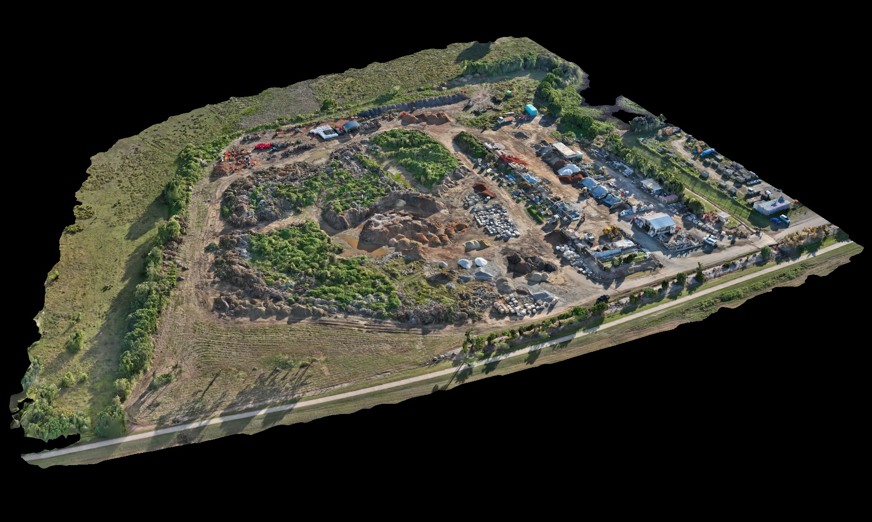
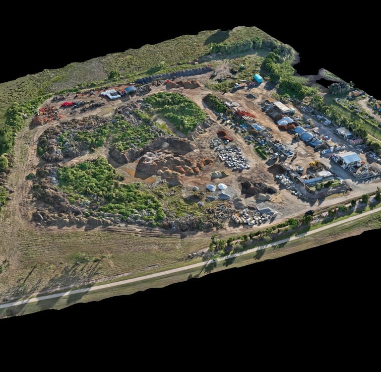
A high-resolution 2D orthomosaic map of the area.
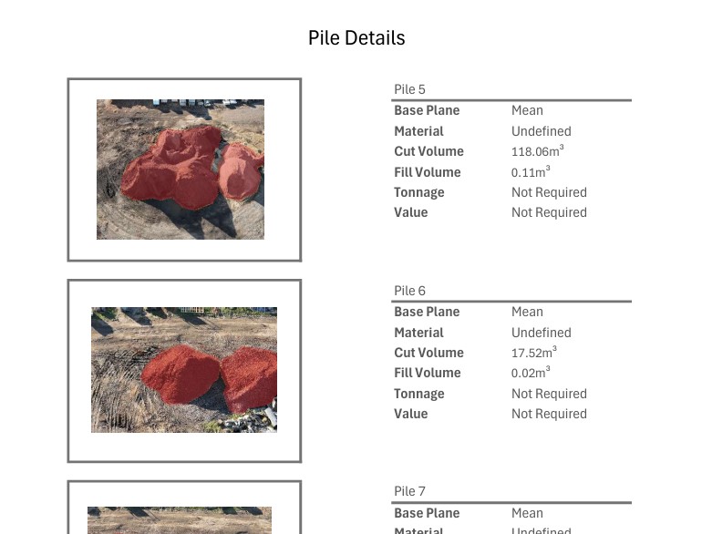
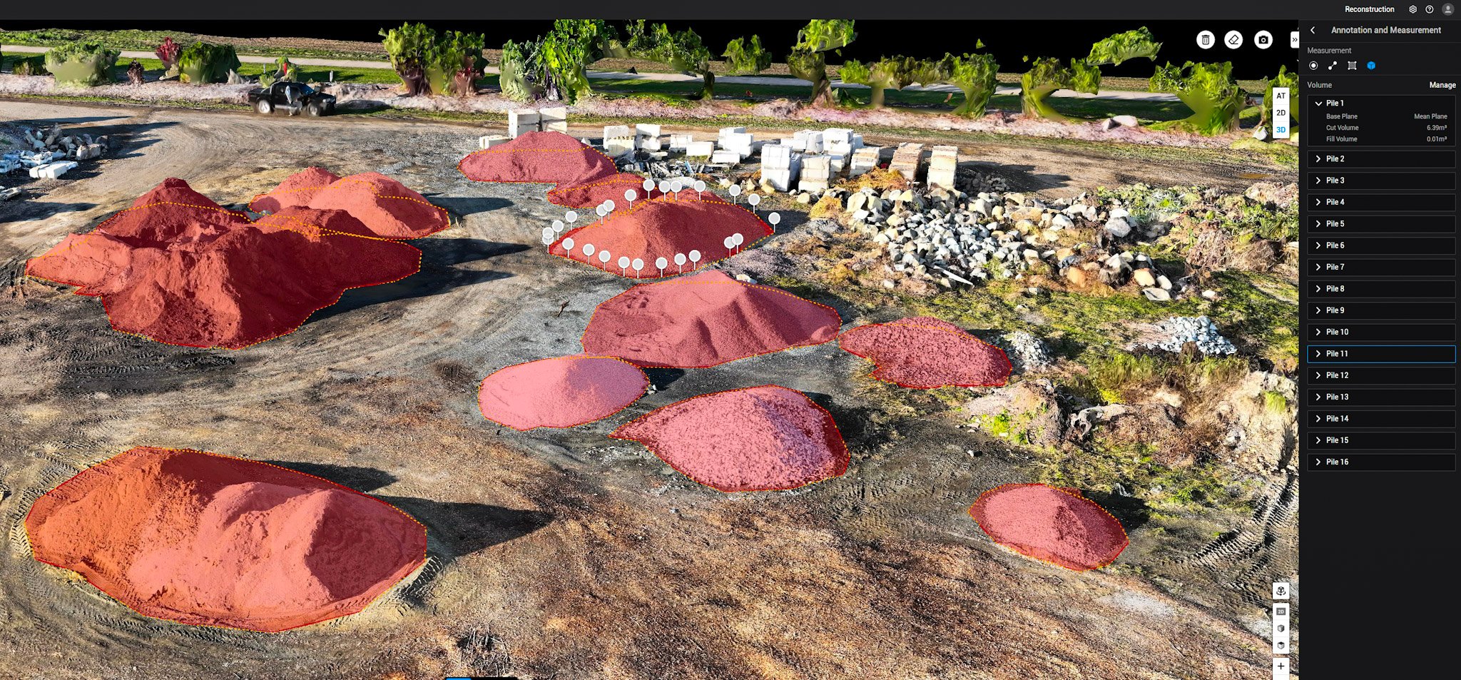
Accurate volumetric measurements of each stockpile in cubic metres.
A comprehensive report listing individual volumes.
High-quality maps and annotated images for internal use.
All data delivered in a structured, professional report format.
Challenges
Volume Accuracy & Accountability
The client required exact cubic metre measurements for internal audits. Even small discrepancies could affect financial valuations, so precise spatial referencing was crucial.Complex Stockpile Geometry
Irregular pile shapes and close spacing between stockpiles made clean edge definition difficult, especially where materials overlapped or blended.Busy Worksite Environment
The yard was operational during the inspection, requiring extra attention to site safety, flight path planning, and timing to avoid machinery and foot traffic.Ground Reference Requirement
RTK alone was not sufficient for the client’s accuracy expectations; Ground Control Points were needed to further validate model positioning and height reference.
Our Solution
We deployed the DJI Matrice 4 Enterprise with RTK in combination with strategically placed Ground Control Points across the site. This approach ensured centimeter-grade positional accuracy for both horizontal and vertical measurements.
Flight planning and execution were handled through DJI Pilot 2, and the collected imagery was processed in DJI Terra. The orthomosaic and 3D model were refined and georeferenced using the GCPs, allowing highly accurate volume calculations for each stockpile.
A fully branded stockpile report was generated and included measurement tables, annotated maps, and aerial imagery.
Workflow Breakdown
1. Pre-Flight Planning
Client consultation to identify stockpiles and priority areas
Site layout mapped with GCP locations selected and surveyed
Autonomous flight paths planned in DJI Pilot 2 with RTK and overlap optimization
2. On-Site Execution
GCPs deployed and measured with high accuracy
RTK drone flight conducted with 80/70 image overlap
Additional oblique and low-altitude imagery captured for reference
Ground control data logged and backed up
3. Processing & Volume Calculation
Images imported to DJI Terra
Orthomosaic generated and georeferenced using GCPs
3D surface model built with refined accuracy
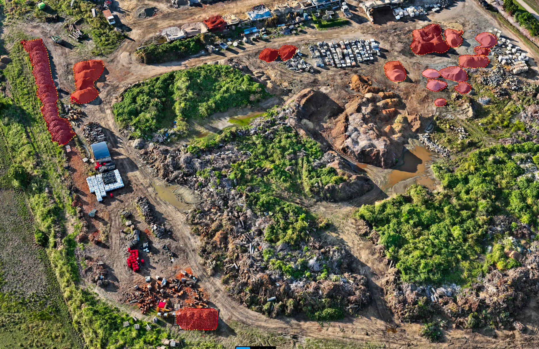
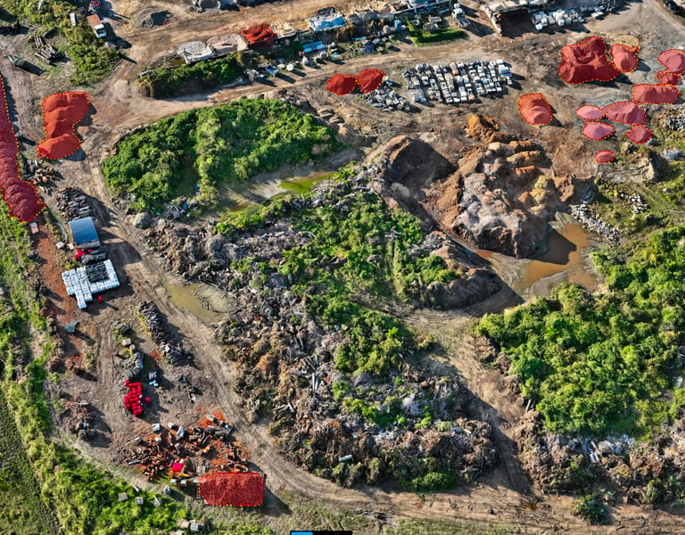
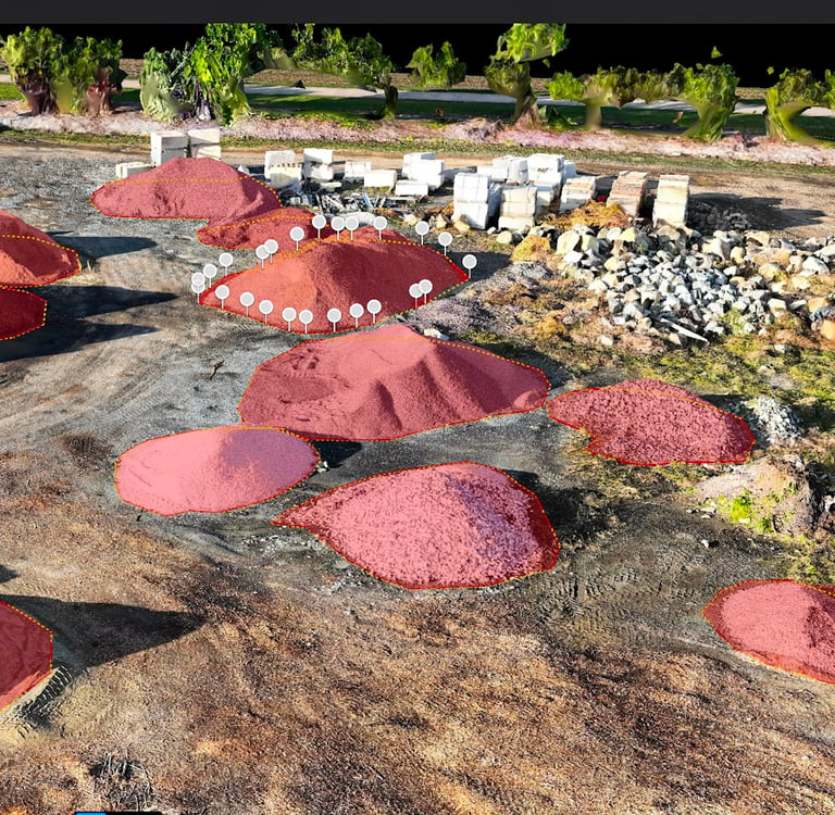
Stockpile outlines manually digitized for clean volume calculation
Volumes calculated in cubic metres using terrain-relative method
4. Reporting & Delivery
Volumes listed in a structured PDF stockpile report
Annotated maps, pile IDs, and imagery included for reference
All files uploaded to a secure client folder with raw exports upon request
Deliverables
High-resolution 2D orthomosaic (GeoTIFF + JPEG)
Accurate 3D surface model with GCP correction
Stockpile volume report in PDF format including:
Individual volumes in m³
Pile IDs and corresponding map locations
Annotated aerial images and pile outlines
Raw and processed data files delivered digitally
Optional printed report and map copies on request
Results & Impact
The client received a precisely measured, clearly presented, and visually documented report that allowed them to:
Audit materials with confidence
Track inventory over time with comparable data
Plan future deliveries and sales with real volumetric data
Avoid manual measurement and improve site safety during assessments
By integrating RTK and GCP workflows, Dimension Drones Mackay ensured a repeatable, accurate, and professional-grade result that now forms part of the client’s quarterly stocktake process.