Radio Tower Inspection and Presice 2D\3D Mapping – Mackay Region
CASE STUDIES
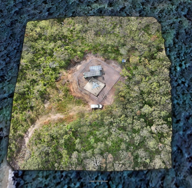
Client: Local Government Entity
Location: South of Mackay, QLD
Project Type: Tower inspection and precise mapping
Technology Used: DJI Matrice 4E, DJI Pilot 2, RTK Module, DJI Terra, Ground Control Points
Objective
The client engaged us to perform a comprehensive aerial inspection and mapping of a critical communications tower in the Mackay region. Their requirements included:
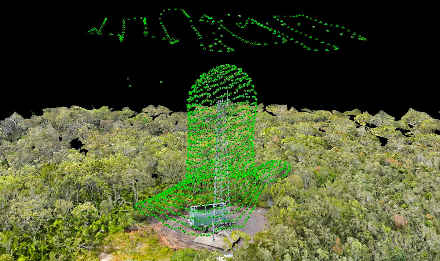
A high-resolution, accurate 3D model of the tower.
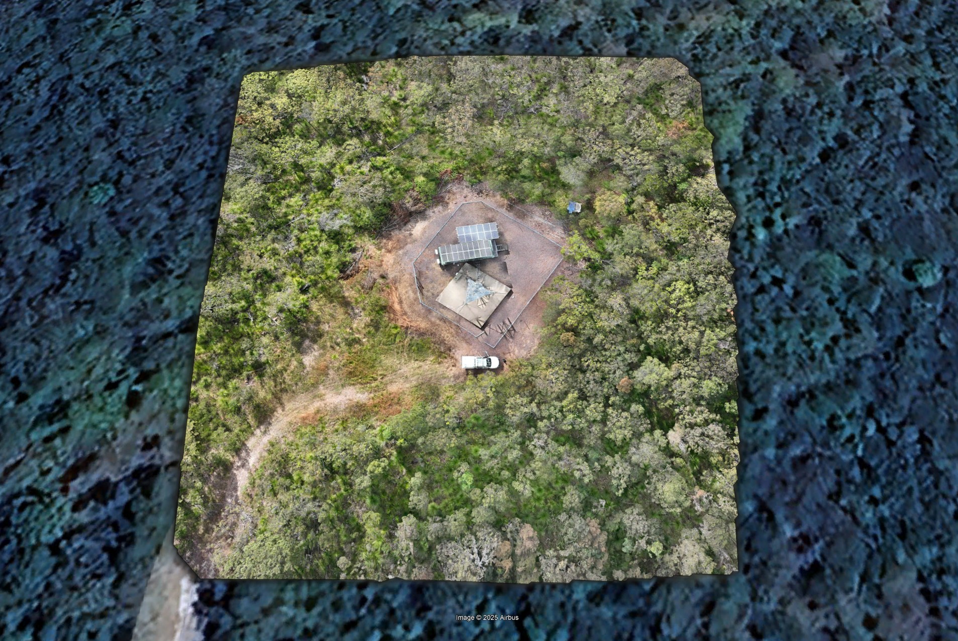
A detailed, high-resolution 2D orthomosaic map of the site.
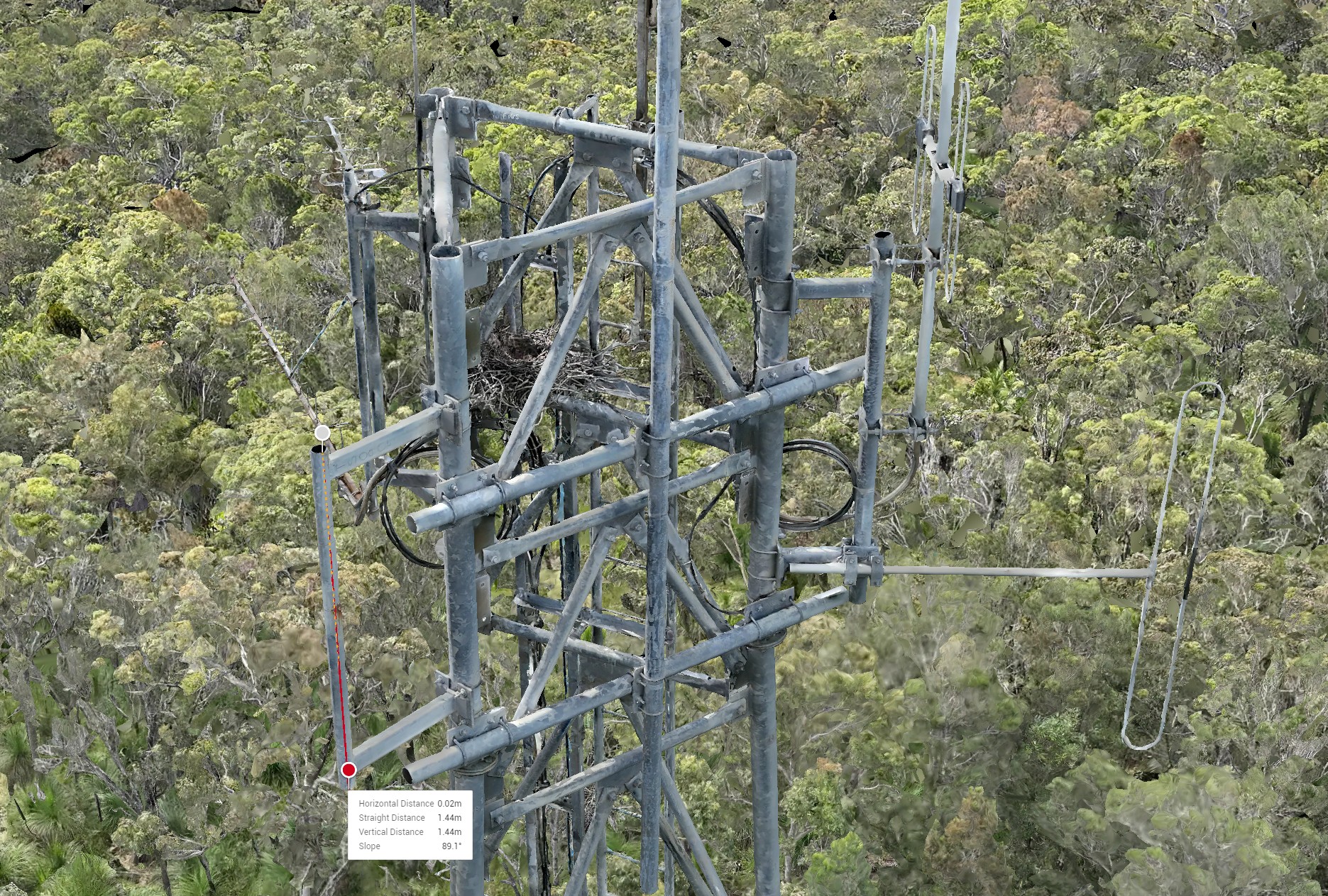
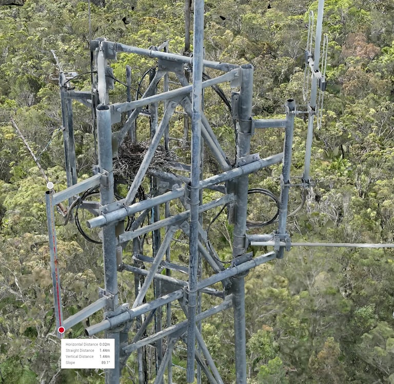
Pre-planned measurements of specific tower components taken directly from the 3D model.
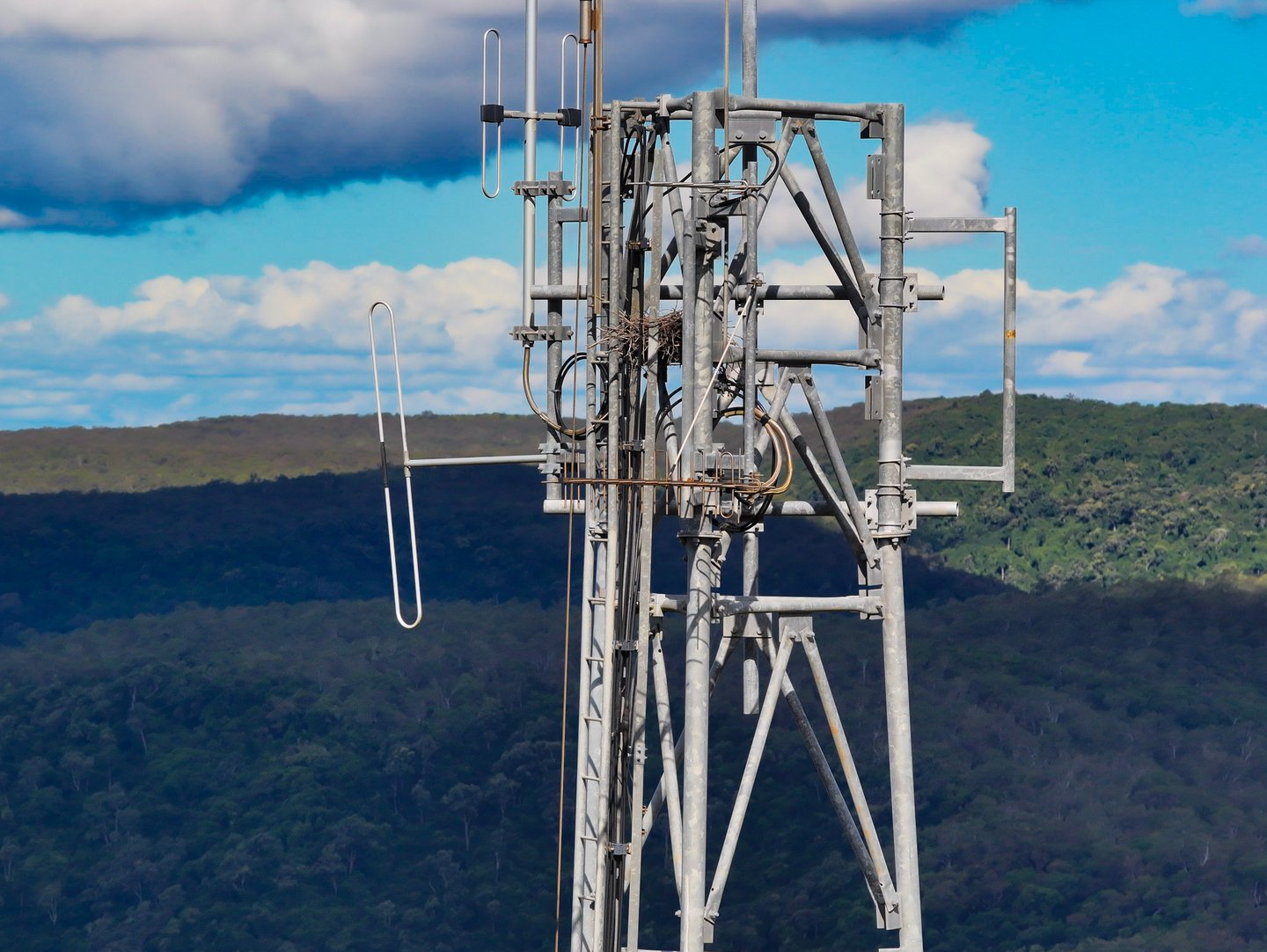
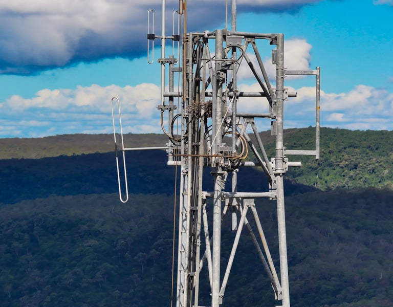
High-resolution images of mounts, cabling, and antennas for condition assessment.
A comprehensive report with visual documentation, annotated maps, and downloadable assets.
This data would support asset documentation, maintenance planning, and structural assessments without the need for manual climbing or on-foot inspections.
Challenges
Tower Geometry & Line-of-Sight
Capturing the full vertical structure of the tower—including detailed elements like mounts and antennas—required careful planning to maintain visual line-of-sight and ensure proper image overlap for 3D reconstruction.Accuracy Requirements
The client needed precise dimensional measurements taken from the 3D model. This demanded an RTK-enabled workflow to ensure centimeter-level spatial accuracy.Access & Safety
The base of the tower was located in uneven terrain with nearby obstacles, requiring careful flight planning and safety precautions to avoid interference or collisions.Image Detail
Components like cables and connectors required close-range, high-resolution imaging without compromising flight safety or image clarity.
Our Solution
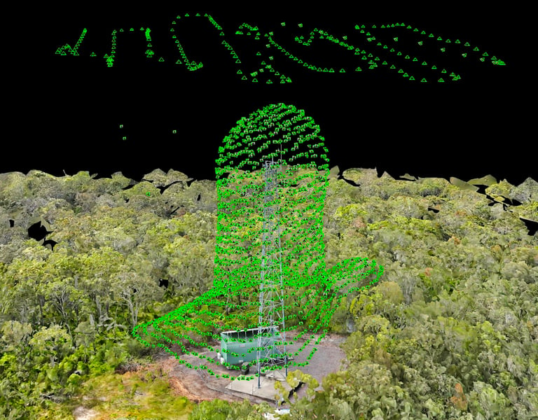
To meet the project's precision and quality requirements, we deployed the DJI Matrice 4 Enterprise with RTK positioning, enabling highly accurate geospatial data collection. Using DJI Pilot 2, we executed a combination of structured orbits and vertical scan flights to capture all required angles with overlapping image sets.
Post-flight, we used DJI Terra to process the data and generate both the 2D orthomosaic and a highly detailed 3D model. Pre-determined measurement points were extracted from the 3D model, and high-resolution photos were isolated and enhanced for the final report.
Workflow Breakdown
1. Pre-Flight Planning
Client briefing to define target components and measurement zones.
Mission planning in DJI Pilot 2 (Ground points + tower mapping + orbit capture).
RTK connection validation and airspace compliance check.
2. On-Site Execution
Ground points established and coordinates recorded.
Drone launched from safe clear zone near the tower.
Multiple altitude passes and oblique angle captures for full model coverage.
Close-range manual image capture of antennas, cabling, and mounts.
All data geotagged with RTK corrections.
3. Processing & Analysis
Image sets imported into DJI Terra.
High-resolution 2D orthomosaic stitched.
Dense 3D mesh model generated.
Measurements taken using model tools with RTK-verified accuracy.
Key visuals and annotations exported for reporting.
4. Reporting & Delivery
High-resolution annotated images processed and enhanced.
PDF report created with all required visuals, measurements, and site data.
Cloud folder setup with raw data, orthomosaic, model exports, and final report.
Deliverables
Accurate 3D model of radio tower (OBJ format).
High-resolution 2D orthomosaic map of surrounding area (GeoTIFF + JPEG).
Pre-measured dimensional data for specific tower features.
20+ high-resolution images of cabling, antennas, and mounts.
Professional PDF inspection report with annotated visuals.
Downloadable asset folder with all raw and processed files.
Results & Impact
The client received a fully documented and highly accurate digital inspection of the tower without needing to dispatch workers for manual climbs. The 3D model provided clear spatial context, allowing engineers to measure components, assess conditions, and plan equipment upgrades remotely.
This inspection not only increased safety and efficiency, but also delivered high-resolution visual evidence for future maintenance and compliance audits. The integration of RTK and DJI Terra workflows demonstrated the power of precision drone mapping in infrastructure inspection.