
Precision Orthomosaic Mapping for Cattle Farm – Sarina, Mackay
CASE STUDIES
Client: Private cattle farming operation
Location: Sarina, Mackay, Queensland
Project Type: Aerial mapping for weed management
Technology Used: DJI Matrice 4E, DJI Pilot 2, RTK Module, DroneDeploy
Objective
The client required highly accurate and up-to-date Orthomosaic maps of a large cattle farm to support targeted weed spraying operations. The aim was to integrate the maps with their DJI Agras T40 Spraying Drone, ensuring precise herbicide application, reducing input costs, and minimizing off-target impacts.
Challenges
The farm presented significant topographical complexity, spanning a wide range of terrain types with dramatic elevation changes across the property.
Drastic height differences not only affect line-of-sight and GPS signal reliability - both critical for accurate drone flight and data capture - but also introduce complications in flight planning and terrain-following capabilities.
The client needed quick turnaround times to align with their spray schedule.
Our Solution
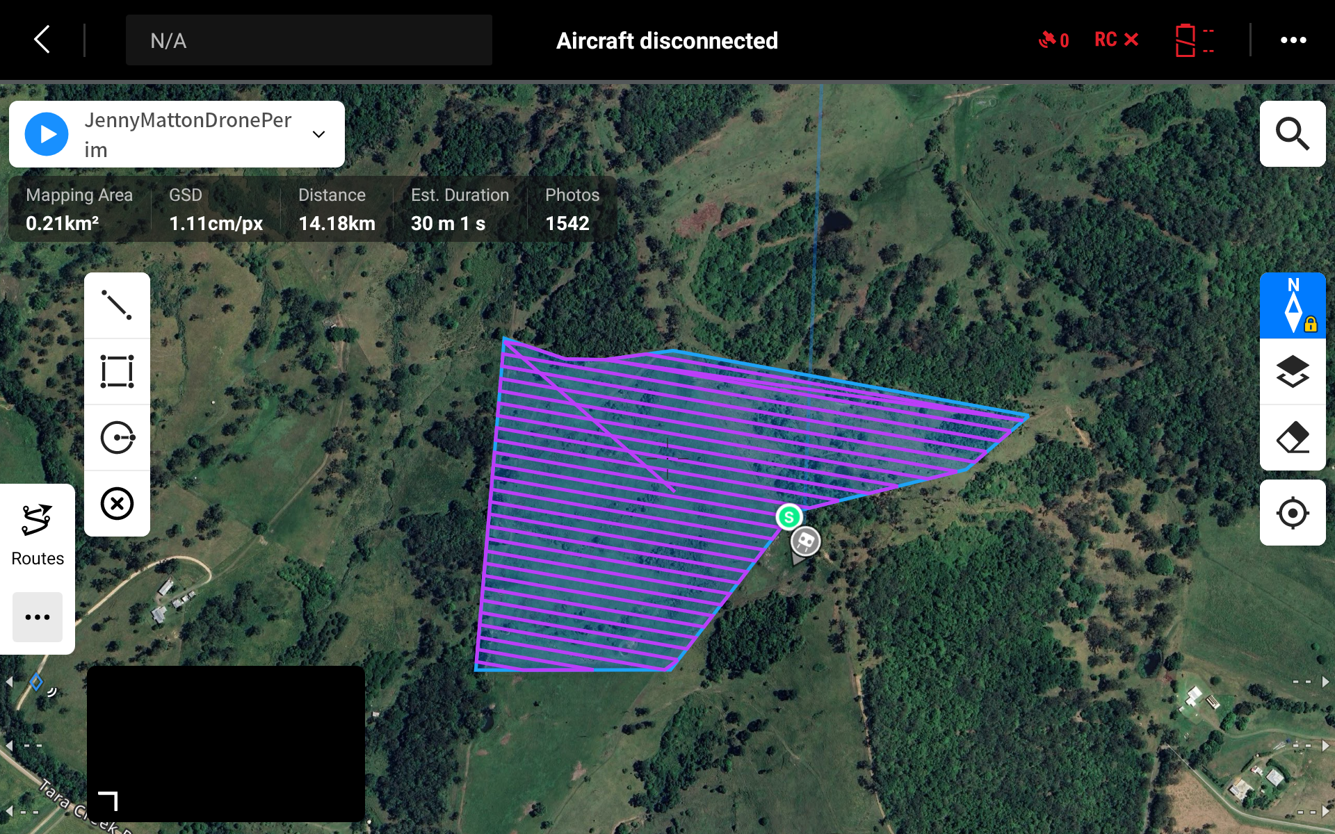
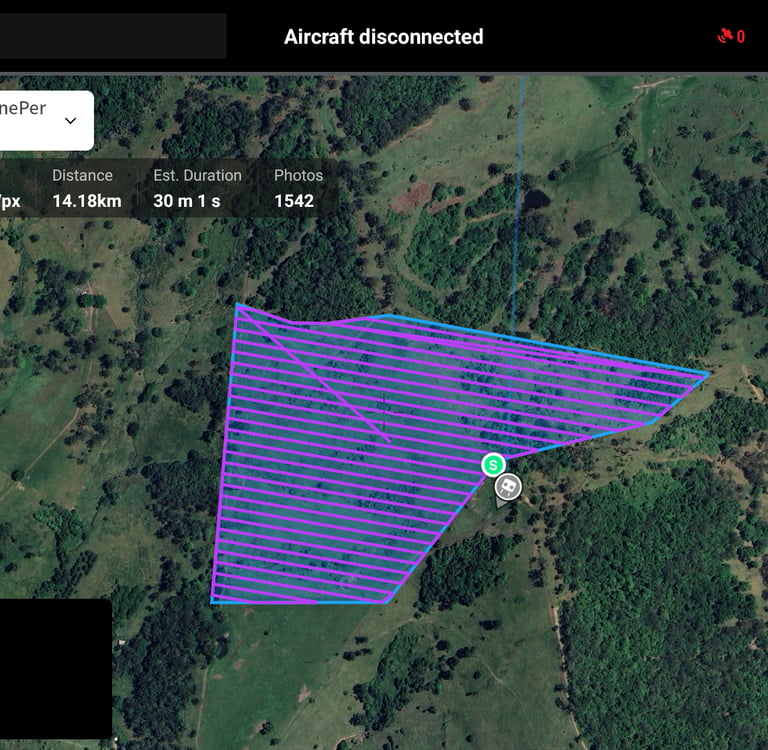
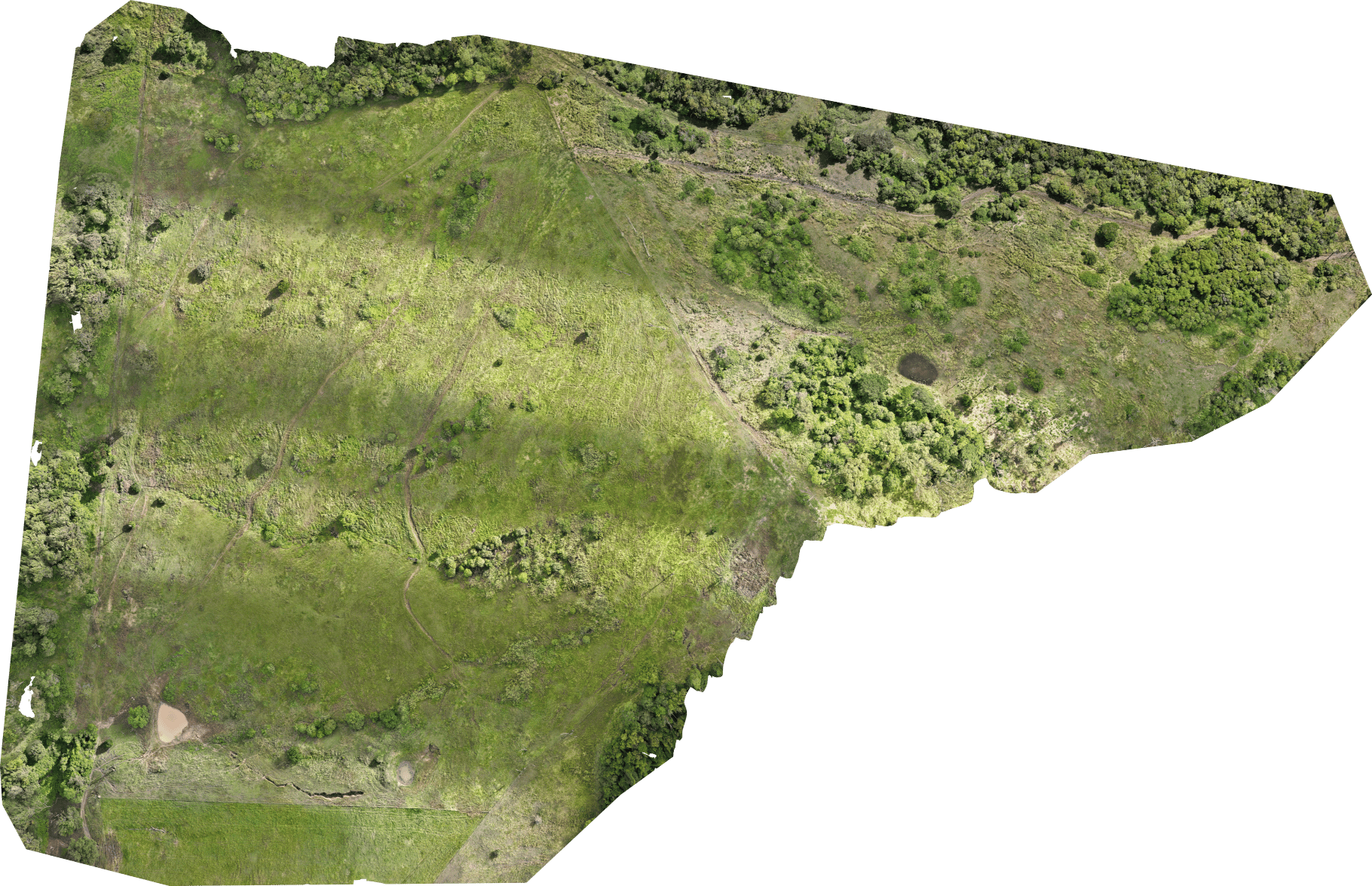
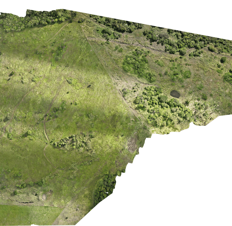
We proposed a full aerial mapping solution using our DJI Matrice 4E drone, paired with an RTK (Real-Time Kinematic) positioning system allowing for <5 centimeter accuracy. The mission was executed using DJI Pilot 2, allowing for automated flight planning, terrain-following capabilities and data capturing. Drone Deploy was then used for post-processing and reporting.
Workflow Breakdown
Site Assessment & Flight Planning
Assessed the terrain and wind conditions to select optimal flight altitudes and patterns.
Set up RTK base station to correct GNSS data and improve spatial accuracy.
Created custom flight plans in DroneDeploy with 80/80 overlap for high-quality stitching.
Data Collection
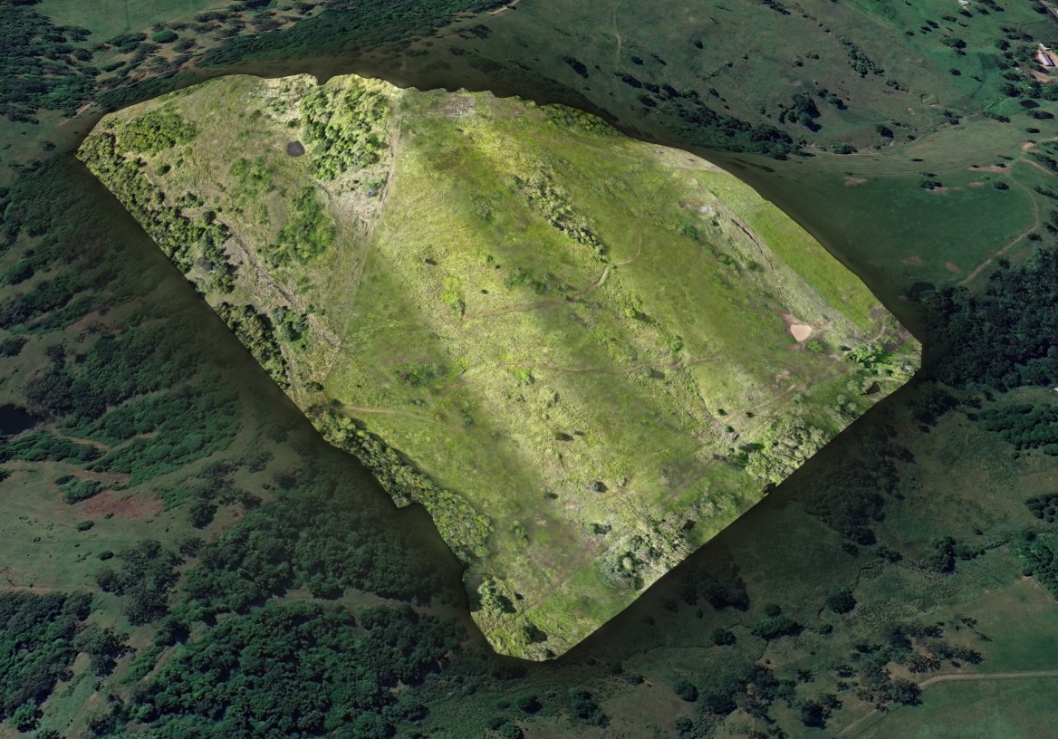
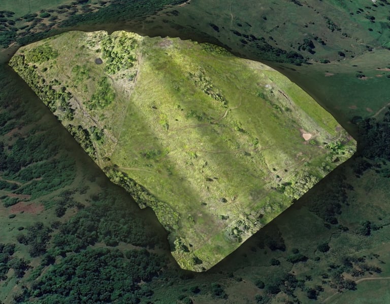
Flew multiple automated grid missions covering approx. 50 hectares.
Collected over 1,200 high-resolution images with ground sample distance (GSD) of ~2.5 cm/pixel.
Ensured flights followed CASA-compliant safety protocols, including airspace checks and observer coordination.
Data Processing & Analysis
Uploaded imagery to DroneDeploy cloud for stitching into a high-resolution Orthomosaic map.
Field boundary shapefiles.
3D mapping (optional).
NDVI layer for vegetation health (optional).
Compatibility confirmation with client's agricultural drone platform.
Deliverables
Orthomosaic map with sub-5cm accuracy.
Field boundary shapefiles.
3D mapping (optional).
NDVI layer for vegetation health (optional).
Recommendations for spray planning based on visible weed clusters.
Compatibility confirmation with client's agricultural drone platform.
Results & Impact
Reduction in herbicide usage through precision application.
Faster decision-making with actionable insights delivered within 48 hours.
Full integration with autonomous spray drone, improving operational efficiency.
Enhanced farm sustainability and compliance with best practices in precision agriculture.